The Sinks Waterfall

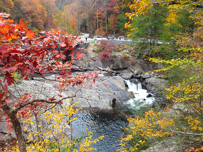
This roadside waterfall on the Little River is one of the most popular destinations in the Great Smoky Mountains National Park. Not only are the Sinks one of the most stunning falls in the Smokies, but they are also extremely accessible and don't require a long hike to reach.
This powerful 15 Ft waterfall is named for the large whirlpool at its base that swirls like water draining in a sink. Like any waterfall in the Smokies, the Sinks are particularly stunning after a large rainstorm in the mountains.
This impressive waterfall channels the entire volume of the Little River and creates strong currents. Over time, the power of the river has created a deep swimming hole that's delightful to enjoy in the summer months.
It's important to be cautious when swimming at the Sinks. Over the years, people have been injured or killed while climbing on rocks or getting swept into the pounding hydraulics of the falls. By not venturing towards the waterfall itself, you can easily enjoy a safe swim here.
If you didn't pack a swimsuit, this waterfall is a beautiful sight. Be sure to bring a camera to take some pictures of this iconic waterfall that passes beneath a bridge on the Little River Road.
Meigs Creek Hiking Trail
The parking area is located right near the sinks, so there's no hiking required to enjoy this stunning waterfall.
However, if you're interested in enjoying a lovely hike to another nearby waterfall, consider trying the Meigs Creek Trail.

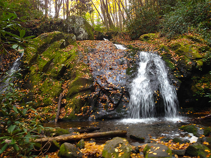
This Hike begins right by the Sinks and brings visitors to several cascades and waterfalls. The 18 Ft tall Meigs Creek Cascades, is the largest on the trail and is only 1.7 miles away from the trailhead.
The trail first climbs up a ridge of Curry He Mountain. This steady climb can require some effort, but you'll be treated to lovely views of the Little River Gorge and surrounding mountains. Once at the top the ridge, you'll be treated to more beautiful views as you descend to Meigs Creek.
This next portion of the trail involves several stream crossings and moves through areas that are regularly flooded. This trail is not recommended after rain storms, as the water may be too high to safely (or dryly) pass. Sturdy boots and trekking poles can make this soggy hike easier. If you visit this trail in the summer, stream crossings are easier as water levels are typically lower.

Because this trail passes so many creeks, there's a good chance you'll meet local wildlife like frogs and salamanders.
The hike to the main waterfall is only a 3.4 round trip, but you could continue to the terminus of the Meigs Creek Trail where it joins Meigs Mountain Trail. This would be a 7-mile round trip hike to return to the Sinks.
Directions and Location
The Sinks parking area is located between Gatlinburg and the Wye near the Townsend entrance of the national park.
Directions From Gatlinburg
From Sugarlands Visitor Center in Gatlinburg, drive 11.5 miles on the Little River Road towards Cades Cove.
From Townsend
From Townsend or Cades Cove, the Sinks are located 5.8 miles on the Little River Road while driving towards Gatlinburg.
Final Thoughts
Looking to experience the Sinks and other sights in this part of the national park? Cabins USA offers many cabin rentals in Wears Valley, TN that are only a short drive from the Sinks, Metcalf Bottoms, Elkmont, and Cades Cove!
Contact:
Little River Rd.
Gatlinburg, TN 37738
Written by Mark Fraizer 2015-11-05">

