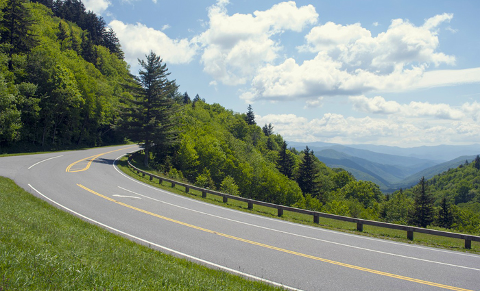
Looking for the best scenic drives in the Smokies? Check out our guide on the best 8 driving roads in the Great Smoky Mountains National Park!
At over 800 sq. miles in size and with over 270 miles of roadways, this national park is best explored by car. Additionally, the Smokies have no entrance fee, so you can enjoy these beautiful driving trails for only the price of fuel. With stunning mountain views, amazing wildlife, and historic cabins, you won't soon forget driving through the Smoky Mountains National Park!
Get ready for an excellent day in the national park with these gorgeous scenic drives in the Smoky Mountains!
1. Newfound Gap Road
One Way Distance: 30.3 Miles
Round Trip: 60.6 Miles
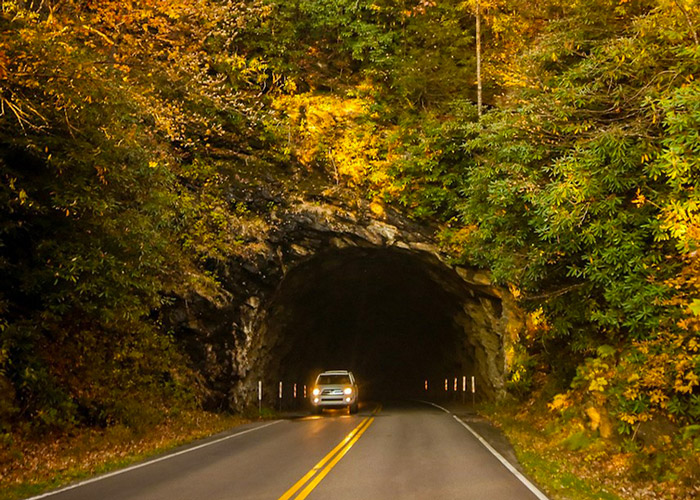
Also known as US-441, The Newfound Gap Road is arguably the most iconic scenic drive in the Smoky Mountains. Beginning at an elevation of 1,289 Ft in Gatlinburg TN, this mountain road climbs to 5,046 Ft at Newfound Gap, the lowest drivable pass in the national park. From Newfound Gap, motorists can descend to Cherokee, NC that rests at an elevation of 1,991 ft.
Along this route, you'll be able to see a variety of forest types as you climb higher in into the mountains. The low elevation regions feature a lush hardwood forest, while the high elevation ridges near Newfound Gap showcase a beautiful spruce-fir forest. Along the way, there are several overlooks with mountain views:
- Campbell Overlook – This impressive pull-off offers stunning views of Mt. Leconte near Gatlinburg.
- The Chimney Tops Overlook – This pull-off features a view of the prominent Chimney Tops outcropping.
- Morton Overlook – Located just below Newfound Gap, this impressive overlook provides a view of the Newfound Gap road.
- Oconoluftee Valley Overlook – This spot offers views of the Oconoluftee Valley in the North Carolina side of the Smoky Mountains.
On the way to Newfound Gap, you'll pass several popular hiking trails including the Alum Cave Trail to Mt. LeConte and the Chimney Tops Trail. The route also passes by the Sugarlands Visitor Center near Gatlinburg and the Oconaluftee Visitor Center near Cherokee.
The main destination of Newfound Gap Road is, of course, Newfound Gap. This high mountain pass marks the state line of Tennessee and North Carolina in the national park. The famous Appalachian Trail passes along this spot on its way to Maine. Additionally, Newfound Gap has historic significance since it is the place where President Roosevelt formally dedicated the national park in 1940 for "the happiness of the American people."
If you only have time to drive one road in the national park, The Newfound Gap road is a truly classic drive through the Smoky Mountains.
2. Little River Road
One Way Distance: 25 Miles
Round Trip: 50 Miles
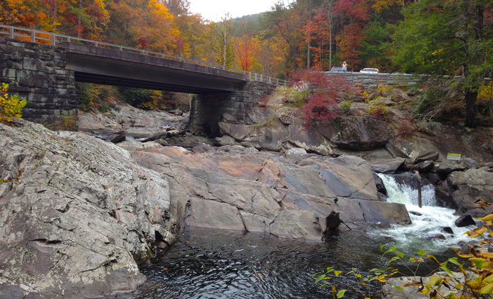
At 25 miles in length, the Little River Road connects Sugarlands Visitor Center near Gatlinburg to the popular Cades Cove region of the Smoky Mountains. Technically, this route consists of 3 roads: Fighting Creek Gap Rd, Little River Gorge Rd, and Laurel Creek Rd.
This low-elevation route is one of the best ways to explore the Tennessee side of the national park and it passes by beautiful areas of the park like Elkmont, Tremont, Metcalf Bottoms, and the Townsend Wye swimming area. If you want to truly drive through the Smoky Mountains, this road is a must see.
Along the way, you'll see impressive sights like The Sinks Waterfall that's located right by the roadside and you'll also pass by popular hiking trails like the Laurel Falls Trail. As its name suggests, this scenic drive follows along the Little River as it passes through verdant forests. There are numerous pull-offs that provide access to the river.
The main highlight of this road is the impressive Cades Cove region of the park, a scenic valley filled with wildlife and historic cabins.
3. The Roaring Fork Motor Trail
One Way Distance: 5.5 Miles
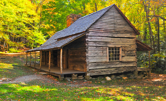
Located just outside of Gatlinburg, the Roaring Fork Motor Trail is one of the most popular driving roads in the national park. This one-way road begins at the end of Cherokee Orchard road and Historic Nature Trail Road can be accessed at traffic light #8 in Gatlinburg, TN.
The Roaring Fork Motor Trail is a low-elevation road in the Smokies that features stunning old-growth forests, historic cabins, lovely waterfalls, and rushing mountain streams.
One of the main stops on the Roaring Fork Motor Trail is the historic Noah "Bud" Ogle farmstead that features a historic cabin, barn and tub mill that were built in the 1880s. This route also passes by the trailhead for the Rainbow Falls Trail and the Grotto Falls Trail that feature stunning waterfalls. These routes also provide access to nearby Mt. LeConte.
For a finale, this route passes by "the place of 1000 drips," a unique roadside waterfall. Since this route begins and ends near Gatlinburg, it's a popular driving road in the Smoky Mountains.
Please note that this road is closed in during the winter months and that buses, trailers, and motor homes are not permitted on the trail.
4. Cades Cove Loop
One Way Distance: 11 Miles
Without a doubt, the Cades Cove Loop road is the most popular driving road in the Great Smoky Mountains National Park.
This scenic, 11-mile loop road meanders through Cades Cove, a historic community in the Smoky Mountains that's surrounded by stunning mountain peaks.
Not only does this historic road feature historic homesteads and lovely mountain views, but it's also one of the best places to view wildlife in the Smoky Mountains. Motorists on this route frequently report seeing black bear, deer, and turkey, especially during the morning hours when these animals are most active.
Some of the main highlights of the Cades Cove Loop road are:
- The John Oliver Cabin – Built in the 1820s, this cabin was the first permanent home European settlers in the cove. Primitive Baptist Church – Built in 1887, this simple church was a center of religious life in the cove.
- The Cades Cove Grist Mill – Built in the 1870s, the Cable Mill is a working mill complete with a water wheel. Nearby, you'll find a unique cantilever barn and other outbuildings.
- The Abrams Falls Trail – This popular waterfall begins at the far end of the Cades Cove loop and takes visitors to the stunning 20-ft tall waterfall.
Please note that traffic is slow on this one-lane route and that Cades Cove can occasionally become very crowded. This is especially true during the busy season in summer and fall. From May to September, the Cades Cove loop is exclusively opened to hikers and bicyclists until 10 a.m. on Wednesdays and Sundays.
Additionally, the Cades Cove loop offers access to the scenic Rich Mountain Road, an unpaved, one-way route in the Smoky Mountains. For more details about this route, check out our guide on the best gravel roads in the Smoky Mountains.
5. Clingman's Dome Road
One Way Distance: 7 Miles
Round Trip: 14 Miles
If you want to drive through high elevation areas of the national park, the Clingman's Dome Road is a must-visit destination. This popular drive begins at the Newfound Gap parking area and leads to Clingman's Dome, the highest peak in the Smokies at an elevation of 6,644 Ft.
As the highest road in the Smokies, Clingman's Dome Road is one of the most impressive drives in the Smoky Mountains. Motorists will enjoy this region's lovely spruce-fir forests that thrive in this mountain's cool, wet conditions.
Along the way, there are several pull-offs that feature gorgeous mountain views. You can also access the Appalachian Trail as it nears the summit of Clingman's Dome.
At the road's terminus, you can access the 0.5-mile Clingman's Dome Trail that leads to a 54-ft observation tower on the mountain's summit. At the top, you'll be treated to stunning, panoramic views from the highest peak in the Smokies.
Additionally, this area of the national park is also home to Andrew's Bald, a unique high elevation field that features excellent views of the North Carolina side of the Smokies. This destination can be reached via the Forney Ridge Trail that begins at the Clingman's Dome parking area.
Please note, this popular drive in the Smokies is closed from December 1 to March 31, due to winter weather conditions.
6. Cataloochee Valley Road
One Way Distance: 7.3 Miles
Round Trip: 14.6 Miles
Much like Cades Cove, the Cataloochee Valley was home to a prosperous community of 1,200 residents prior to the formation of the Great Smoky Mountains National Park. Located on the North Carolina side of the park, this remote valley features historic cabins, beautiful mountain views, and the national park's only wild elk herd.
The entrance road to Cataloochee Valley is one of the prettiest drives in the Smokies, but the road is narrow and unpaved. The best route to Cataloochee Valley is Cove Creek road that can be accessed from I-40.
Though the Cataloochee Valley road, it is probably one of the most underrated scenic drives in the Smoky Mountains.
Because this rugged mountain road is unpaved, driving to Cataloochee Valley takes approximately 45 minutes.
7. Balsam Mountain Heintooga Ridge
One Way Distance: 14 Miles
This secluded, unpaved road begins just off of the Blue Ridge Parkway near Cherokee, NC. This curvy mountain road begins at an elevation of 5,535 Ft. and descends about 2,000 feet along the way. This high-elevation gravel road is an excellent way to explore the different plant life that exists in different elevations of the park.
Please note that this driving route in the Smokies is closed during the winter months. Additionally, this road is named Balsam Mountain Road on national park maps, but the signage for this road calls it Heintooga Ridge.
8. The Foothills Parkway
One Way Distance: 17 Miles
Round Trip: 34 Miles
First envisioned in the 1940s, the Foothills Parkway was a grand public works project that was meant to build a 72-mile road that connected I-40 to Lake Chilhowee.
However, the project soon ran into budget shortfalls and environmental concerns, so only some sections of this scenic road have been completed.
As of 2018, the longest completed section of the Foothills Parkway stretches 17 miles from Walland, TN to Lake Chilhowee.
Though this road is not technically inside the Great Smoky Mountains, it is maintained by the national park service. As the name suggests, this road straddles the scenic foothills of the Smokies. This picturesque road follows a mountain ridge, so the foothills parkway offers views of the towering Smoky Mountains in the distance.
Additionally, this scenic route will soon be expanded. With the recent completion of the "missing link." This addition will add 15.8 miles to the existing stretch of the Foothills Parkway. Additionally, this new section of road will offer impressive views of the Townsend Valley.
Once the "missing link" is completed, motorists will be able to enjoy this Smoky Mountain road that connects Wears Valley, TN to Lake Chilhowee.
Map Of Scenic Roads in the Smoky Mountains
Final Thoughts
Many of these roads are curvy and have low speed limits, so please exercise caution on these scenic roads.
In addition to these top driving roads in the Smoky Mountains, check out our guide on the best motorcycle roads in the Smokies.
With these excellent scenic drives in the Great Smoky Mountains, we hope you can get the best out of your Pigeon Forge cabin trip! We'd love to know, what's your favorite drive in the Smoky Mountains? Have you driven all of these driving roads in the national park? Please share your thoughts in our comments section!
Written by Mark Frazier


